 Web Content Viewer
 Web Content Viewer
 Web Content Viewer
Help your customer visually represent data on a map or aerial photo and then filter that data to produce a type of visual report.
This application is called Geographic Information System (GIS) and is controlled through software applications such as ArcGIS and ArcView, both created by ESRI. Though computer-based, GIS is basically a map at heart. Customers will always need print hard copies and will demand fine crisp lines, vibrant colors, and extreme accuracy as well as fast turnaround in instances such as weather warnings or other emergency situations. Productivity is essential for printing GIS applications. Many times, the files sizes are extremely large, which means you need easy job submission tools to process these files correctly and quickly. GIS maps are often taken out in the field under extreme weather conditions, necessitating the ability to print on durable media like Tyvek to ensure the maps are not damaged. Learn how offering GIS printing applications can help grow your customer base.
 Web Content Viewer
Construction
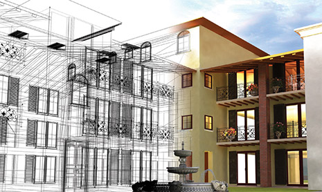
GIS in construction allows for better and more economical designs, safer structures, and better built parks and roads. GIS is becoming critical in the construction industry as it is crucial to have accurate spatial descriptions, aerials of potential construction sites whether it be for new roads or a city park. Without a mapped overview of the land, it would be impossible for the correct and safe construction of an infrastructure. Add this application to your production service to grow your business by attracting new print customers. Large format systems capable of printing construction applications include: Colorado UVgel Roll-to-Roll printers, Arizona UV Flatbed printers, and imagePROGRAF series printers.

 Web Content Viewer

Directional
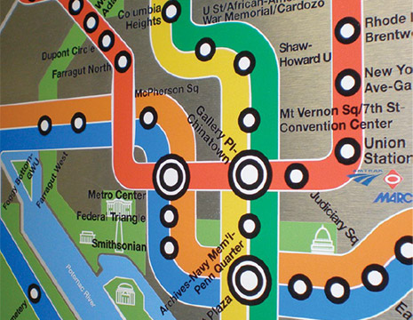
Directional GIS applications are intended to assist a person in getting to a location, whether by foot, air, or vehicle. Used for directional GIS include road maps, parks and recreational maps, work site maps, and many more. It is also extremely important in some instances to have a printed hard copy of a map on hand in instances of an emergency. For example, if there is a fire in a building, it is important to know immediately where the closest exits are as well as where the firefighting equipment is located. Directional GIS allows people to have a hard copy of a map which gives them clear and accurate directions as to their desired location. GIS can be printed on basically any media types from bond to Tyvek to removable adhesive media. This is an ideal application to realize new revenue streams for your business. Systems capable of printing directional applications include: Colorado UVgel Roll-to-Roll printers, Arizona UV Flatbed printers, Texas UV Flatbed Printers, imagePROGRAF series printers, and Finishing Options.
 Web Content Viewer
Outdoor
Outdoor GIS applications are intended for longer term use. It can be extremely expensive to have to print out multiple sets in a day for your construction crew, whether the prints get damaged due to weather, basic wear or tear or a simple coffee spill, being able to print your GIS work on a weather-resistant media such as Tyvek allows you to keep the prints intact for a longer period of time thus cutting your reprint costs. This is extremely popular in the construction industry, landscaping, utilities, the field branches of the military, and rescue and recovery organizations. Products capable of printing outdoor GIS applications include: Colorado UVgel Roll-to-Roll printers, Arizona UV Flatbed printers, Texas UV Flatbed Printers, imagePROGRAF series printers, and Finishing Options.

